| Shenandoah National Park | |
|---|---|
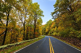
 Skyline Drive | |
| Location | Virginia, United States |
| Nearest city | Luray, Front Royal, Elkton, Waynesboro |
| Coordinates | 38°32′N 78°21′W / 38.533°N 78.350°W |
| Area | 199,173 acres (311.208 sq mi; 806.02 km2)[1] |
| Established | December 26, 1935 |
| Visitors | 1,666,265 (in 2020)[2] |
| Governing body | National Park Service |
| Website | Shenandoah National Park |
Shenandoah National Park /ˈʃɛnənˌdoʊə/ (often /ˈʃænənˌdoʊə/) is a national park of the United States that encompasses part of the Blue Ridge Mountains in Virginia. The park is long and narrow, with the Shenandoah River and its broad valley to the west, and the rolling hills of the Virginia Piedmont to the east. Skyline Drive is the main park road, generally traversing along the ridgeline of the mountains. Almost 40% of the park's land—79,579 acres (124 sq mi; 322 km2)—has been designated as wilderness areas and is protected as part of the National Wilderness Preservation System. The highest peak is Hawksbill Mountain at 4,051 feet (1,235 m).
- ^ "Listing of acreage – December 31, 2011" (XLSX). Land Resource Division, National Park Service. Retrieved March 7, 2012. (National Park Service Acreage Reports)
- ^ "NPS Annual Recreation Visits Report". National Park Service. Retrieved March 11, 2019.

