Shenandoah Valley Regional Airport | |||||||||||
|---|---|---|---|---|---|---|---|---|---|---|---|
 | |||||||||||
| Summary | |||||||||||
| Airport type | Public | ||||||||||
| Owner | Shenandoah Valley Regional Airport Comm. | ||||||||||
| Serves | Staunton, Waynesboro, Harrisonburg | ||||||||||
| Location | Weyers Cave, Virginia | ||||||||||
| Opened | 1958[1] | ||||||||||
| Elevation AMSL | 1,201 ft / 366 m | ||||||||||
| Coordinates | 38°15′50″N 078°53′47″W / 38.26389°N 78.89639°W | ||||||||||
| Website | www | ||||||||||
| Map | |||||||||||
 | |||||||||||
| Runways | |||||||||||
| |||||||||||
| Statistics (2021) | |||||||||||
| |||||||||||
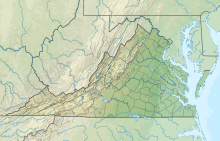
Shenandoah Valley Regional Airport (IATA: SHD, ICAO: KSHD, FAA LID: SHD) is in the census-designated place of Weyers Cave, Virginia, United States, 5 miles (8.0 km) west of the Town of Grottoes and 12 miles (19 km) northeast of the City of Staunton.[2] It is used for general aviation and is served by one airline, subsidized by the Essential Air Service program.
The airport is operated by the Shenandoah Valley Regional Airport Commission, with members from the cities of Staunton, Waynesboro and Harrisonburg, and the counties of Augusta and Rockingham.
Federal Aviation Administration records say the airport had 7,746 passenger boardings (enplanements) in calendar year 2008,[3] 8,364 in 2009 and 10,408 in 2010.[4] The National Plan of Integrated Airport Systems for 2011–2015 categorized it as a non-primary commercial service airport based on enplanements in 2008/2009 (between 2,500 and 10,000 per year).[5]
- ^ Cite error: The named reference
decadeswas invoked but never defined (see the help page). - ^ a b FAA Airport Form 5010 for SHD PDF. Federal Aviation Administration. Effective July 13, 2023.
- ^ "Enplanements for CY 2008" (PDF, 1.0 MB). CY 2008 Passenger Boarding and All-Cargo Data. Federal Aviation Administration. December 18, 2009.
- ^ "Enplanements for CY 2010" (PDF, 189 KB). CY 2010 Passenger Boarding and All-Cargo Data. Federal Aviation Administration. October 4, 2011.
- ^ "2011–2015 NPIAS Report, Appendix A" (PDF, 2.03 MB). National Plan of Integrated Airport Systems. Federal Aviation Administration. October 4, 2010.

