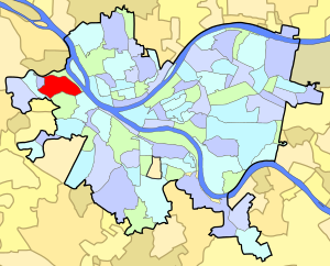
Sheraden | |
|---|---|
 | |
 | |
| Coordinates: 40°27′22″N 80°03′29″W / 40.456°N 80.058°W | |
| Country | United States |
| State | Pennsylvania |
| County | Allegheny County |
| City | Pittsburgh |
| Area | |
• Total | 0.69 sq mi (1.8 km2) |
| Population (2010)[1] | |
• Total | 5,299 |
| • Density | 7,700/sq mi (3,000/km2) |
Sheraden is a neighborhood that is located in the West End of Pittsburgh, Pennsylvania in the United States.[2] Nearby neighborhoods include Windgap, Chartiers City, Crafton Heights, Esplen, and Elliott.
- ^ a b "PGHSNAP 2010 Raw Census Data by Neighborhood". Pittsburgh Department of City Planning PGHSNAP Utility. 2012. Retrieved 28 June 2013.
- ^ "Sheraden". Pittsburgh City Council official website. Retrieved 16 May 2011.