This article needs additional citations for verification. (January 2011) |
| Shieldhill | |
|---|---|
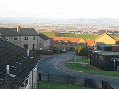
 in the west of the village looking over the Forth Valley | |
Location within the Falkirk council area | |
| Area | 0.24 sq mi (0.62 km2) |
| Population | 2,380 (2022)[1] |
| • Density | 9,917/sq mi (3,829/km2) |
| OS grid reference | NS899769 |
| • Edinburgh | 22.4 mi (36.0 km) ESE |
| • London | 343 mi (552 km) SSE |
| Civil parish | |
| Council area | |
| Lieutenancy area | |
| Country | Scotland |
| Sovereign state | United Kingdom |
| Post town | Falkirk |
| Postcode district | FK1 |
| Dialling code | 01324 |
| Police | Scotland |
| Fire | Scottish |
| Ambulance | Scottish |
| UK Parliament | |
| Scottish Parliament | |
| Website | falkirk.gov.uk |
Shieldhill is a village within the Falkirk council area in Central Scotland. The village is two miles (three kilometres) southeast of Falkirk, 2+1⁄2 miles (4 kilometres) southwest of Polmont and 1⁄2 mile (800 metres) north of California.
Shieldhill is divided into a few main parts: " The California end" and the old " scheme end " to the west, and the newer Bovis and the original old miners rows which have existed in some way for approximately 150 years. The main road through Shieldhill is the B8028 road between California and Glen Village and the B810 road from Reddingmuirhead. At the time of the 2001 census, Shieldhill had a population of 2,656 residents.[2]
- ^ "Mid-2020 Population Estimates for Settlements and Localities in Scotland". National Records of Scotland. 31 March 2022. Retrieved 31 March 2022.
- ^ No 3 - 2001 Census Population of settlements and wards Archived 2011-06-03 at the Wayback Machine www.falkirk.gov.uk. Retrieved 2011-05-11
