Ship Bottom, New Jersey | |
|---|---|
 Long Beach Boulevard in Ship Bottom | |
| Motto: "Gateway to Long Beach Island"[1] | |
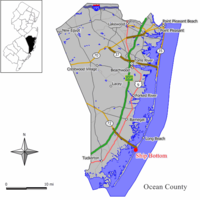
 Map of Ship Bottom in Ocean County. Inset: Location of Ocean County highlighted in the State of New Jersey. | |
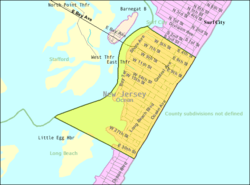
 Census Bureau map of Ship Bottom, New Jersey | |
Location in Ocean County Location in New Jersey | |
| Coordinates: 39°38′43″N 74°10′59″W / 39.645354°N 74.183003°W[2][3] | |
| Country | |
| state | |
| County | |
| Incorporated | March 3, 1925 as Ship Bottom-Beach Arlington |
| Renamed | 1947 as Ship Bottom |
| Government | |
| • Type | Borough |
| • Body | Borough Council |
| • Mayor | William Huelsenbeck (R, term ends December 31, 2026)[4][5] |
| • Administrator | Mark A. Pino[6] |
| • Municipal clerk | Kristy Davis[7] |
| Area | |
| • Total | 0.99 sq mi (2.58 km2) |
| • Land | 0.71 sq mi (1.84 km2) |
| • Water | 0.28 sq mi (0.73 km2) 28.48% |
| • Rank | 500th of 565 in state 24th of 33 in county[2] |
| Elevation | 3 ft (0.9 m) |
| Population | |
| • Total | 1,098 |
| • Estimate (2023)[12] | 1,114 |
| • Rank | 527th of 565 in state 28th of 33 in county[13] |
| • Density | 1,541.8/sq mi (595.3/km2) |
| • Rank | 332nd of 565 in state 17th of 33 in county[13] |
| Time zone | UTC−05:00 (Eastern (EST)) |
| • Summer (DST) | UTC−04:00 (Eastern (EDT)) |
| ZIP Code | |
| Area code(s) | 609 exchanges: 207, 361, 492, 494[16] |
| FIPS code | 3402967110[2][17][18] |
| GNIS feature ID | 0885394[2][19] |
| Website | www |
Ship Bottom is a borough situated on the Jersey Shore, within Ocean County in the U.S. state of New Jersey. As of the 2020 United States census, the borough's population was 1,098,[11] a decrease of 58 (−5.0%) from the 2010 census count of 1,156,[20][21] which in turn had reflected a decline of 228 (−16.5%) from the 1,384 counted in the 2000 census.[22] The borough is located on Long Beach Island and borders the Atlantic Ocean. The summer population can climb as high as 20,000.[23]
The borough's name was derived from a March 1817 incident in which a woman was saved from a wrecked ship that had capsized as her rescuers used axes to cut through the bottom of the hull.[1][24]
What is now Ship Bottom was originally incorporated as the borough of Ship Bottom-Beach Arlington by an act of the New Jersey Legislature on March 3, 1925, from portions of Long Beach Township, based on the results of a referendum held on May 23, 1925. The borough name was shortened to Ship Bottom in 1947.[25]
The borough is known as the "Gateway to Long Beach Island", as Route 72 provides the sole road access from Manahawkin in Stafford Township, ending in Ship Bottom as it crosses Manahawkin Bay via the Manahawkin Bay Bridge (formally known as the Dorland J. Henderson Memorial Bridge).
- ^ a b History of Ship Bottom, Borough of Ship Bottom. Accessed August 31, 2020. "Ship Bottom is one of the oldest place names on Long Beach Island. According to the local historian John Bailey Lloyd, author of Six Miles at Sea, the name dates from an unusual shipwreck that occurred in March, 1817.... With an ax, Willets chopped a hole in the ship's bottom near the keel and, after much struggling, freed the young woman trapped inside.... But the place of the shipwreck and the rescue became known as 'Ship Bottom'."
- ^ a b c d 2019 Census Gazetteer Files: New Jersey Places, United States Census Bureau. Accessed July 1, 2020.
- ^ US Gazetteer files: 2010, 2000, and 1990, United States Census Bureau. Accessed September 4, 2014.
- ^ Cite error: The named reference
Administrationwas invoked but never defined (see the help page). - ^ 2023 New Jersey Mayors Directory, New Jersey Department of Community Affairs, updated February 8, 2023. Accessed February 10, 2023.
- ^ Borough Administrator, Borough of Ship Bottom. Accessed May 25, 2022.
- ^ Municipal Clerk's Office, Borough of Ship Bottom. Accessed May 25, 2022.
- ^ Cite error: The named reference
DataBookwas invoked but never defined (see the help page). - ^ "ArcGIS REST Services Directory". United States Census Bureau. Retrieved October 11, 2022.
- ^ U.S. Geological Survey Geographic Names Information System: Borough of Ship Bottom, Geographic Names Information System. Accessed March 14, 2013.
- ^ a b Cite error: The named reference
LWD2020was invoked but never defined (see the help page). - ^ Cite error: The named reference
PopEstwas invoked but never defined (see the help page). - ^ a b Population Density by County and Municipality: New Jersey, 2020 and 2021, New Jersey Department of Labor and Workforce Development. Accessed March 1, 2023.
- ^ Look Up a ZIP Code for Ship Bottom, NJ, United States Postal Service. Accessed January 1, 2013.
- ^ Zip Codes, State of New Jersey. Accessed August 30, 2013.
- ^ Area Code Lookup - NPA NXX for Ship Bottom, NJ, Area-Codes.com. Accessed January 30, 2017.
- ^ U.S. Census website, United States Census Bureau. Accessed September 4, 2014.
- ^ Geographic Codes Lookup for New Jersey, Missouri Census Data Center. Accessed April 1, 2022.
- ^ US Board on Geographic Names, United States Geological Survey. Accessed September 4, 2014.
- ^ Cite error: The named reference
Census2010was invoked but never defined (see the help page). - ^ Cite error: The named reference
LWD2010was invoked but never defined (see the help page). - ^ Table 7. Population for the Counties and Municipalities in New Jersey: 1990, 2000 and 2010, New Jersey Department of Labor and Workforce Development, February 2011. Accessed May 1, 2023.
- ^ Facts, Borough of Ship Bottom. Accessed May 25, 2022. "Summer Population: Approximately 20,000"
- ^ Hutchinson, Viola L. The Origin of New Jersey Place Names, New Jersey Public Library Commission, May 1945. Accessed October 3, 2015.
- ^ Snyder, John P. The Story of New Jersey's Civil Boundaries: 1606-1968, Bureau of Geology and Topography; Trenton, New Jersey; 1969. p. 205. Accessed May 30, 2024.


