This article needs additional citations for verification. (July 2019) |
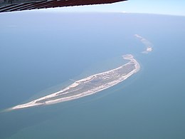
 Aerial view of previously divided Ship Island, looking east (with West Ship Island in foreground) | |
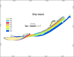
 Historical map of the changing geomorphology of Ship Island | |
| Geography | |
|---|---|
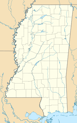
| Location | Gulf of Mexico |
| Coordinates | 30°13′N 88°55′W / 30.217°N 88.917°W |
| Archipelago | Mississippi–Alabama barrier islands |
| Administration | |
| State | Mississippi |
| County | Harrison County |
Ship Island is a barrier island off the Gulf Coast of Mississippi, one of the Mississippi–Alabama barrier islands. Hurricane Camille split the island into two separate islands (West Ship Island and East Ship Island) in 1969. In early 2019, the US Army Corps of Engineers completed the first stage of a project rejoining the two islands and recreating one Ship Island.[1] Ship Island is the site of Fort Massachusetts (built 1859–66), as a Third System fortification. Part of the island is included in the Gulf Islands National Seashore.
- ^ "Ship Island off Mississippi Coast is one island again | Biloxi Sun Herald". www.sunherald.com. Archived from the original on 20 February 2019. Retrieved 17 January 2022.
