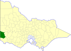
| Shire of Glenelg Victoria | |||||||||||||||
|---|---|---|---|---|---|---|---|---|---|---|---|---|---|---|---|
 Location in Victoria | |||||||||||||||
| Population | 4,270 (1992)[1] | ||||||||||||||
| • Density | 1.1941/km2 (3.093/sq mi) | ||||||||||||||
| Established | 1863 | ||||||||||||||
| Area | 3,576 km2 (1,380.7 sq mi) | ||||||||||||||
| Council seat | Casterton | ||||||||||||||
| Region | Barwon South West | ||||||||||||||
| County | Dundas, Follett, Normanby | ||||||||||||||
 | |||||||||||||||
The Shire of Glenelg was a local government area about 360 kilometres (224 mi) west of Melbourne, the state capital of Victoria, Australia. The shire covered an area of 3,576 square kilometres (1,380.7 sq mi), and existed from 1863 until 1994.