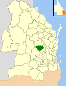
| Shire of Kingaroy Queensland | |||||||||||||||
|---|---|---|---|---|---|---|---|---|---|---|---|---|---|---|---|
 Location within Queensland | |||||||||||||||
| Population | 12,285 (2006 census)[1] | ||||||||||||||
| • Density | 5.07582/km2 (13.1463/sq mi) | ||||||||||||||
| Established | 1912 | ||||||||||||||
| Area | 2,420.3 km2 (934.5 sq mi) | ||||||||||||||
| Council seat | Kingaroy | ||||||||||||||
| Region | South Burnett | ||||||||||||||
 | |||||||||||||||
| Website | Shire of Kingaroy | ||||||||||||||
| |||||||||||||||
The Shire of Kingaroy was a local government area in the South Burnett area of Queensland, Australia, about 100 kilometres (62 mi) northwest of the capital, Brisbane. The shire covered an area of 2,420.3 square kilometres (934.5 sq mi), and existed as a local government area from 1912 until 2008, when it amalgamated with a number of other local government areas in the South Burnett area to become the South Burnett Region.
The seat of the shire was the town of Kingaroy, which continues as the set of the South Burnett Region.
The shire's name derives from the Wakka Wakka Aboriginal words "king dhu'roi", meaning "ant hungry". While land use was dominantly pastoral in the area's early European history, dairying, beef, small crops and in particular peanut farming became mainstays of Kingaroy's economy.
- ^ Australian Bureau of Statistics (25 October 2007). "Kingaroy (S) (Local Government Area)". 2006 Census QuickStats. Retrieved 18 March 2008.