Shirley | |
|---|---|
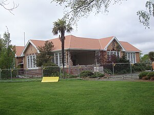
 The Shirley Community Centre displaying significant earthquake damage | |
 | |
| Coordinates: 43°30′14″S 172°39′39″E / 43.503963°S 172.660879°E | |
| Country | New Zealand |
| City | Christchurch |
| Local authority | Christchurch City Council |
| Electoral ward |
|
| Community board |
|
| Area | |
| • Land | 333 ha (823 acres) |
| Population (June 2024)[2] | |
• Total | 6,990 |
| Marshland | Prestons | |
| Mairehau |
|
Burwood |
| Edgeware | Dallington Richmond |
(Residential red zone) |
Shirley, sometimes referred to as Windsor, is a suburb of Christchurch, New Zealand, about 5 kilometres (3.1 mi) north-east of the city centre. The area was used for farming from the 1850s, and subdivision started in the early 20th century, with most of the houses being built between 1950 and 1980.
- ^ Cite error: The named reference
Areawas invoked but never defined (see the help page). - ^ "Aotearoa Data Explorer". Statistics New Zealand. Retrieved 26 October 2024.