This article includes a list of general references, but it lacks sufficient corresponding inline citations. (March 2012) |
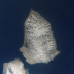
 A Landsat 7 image of Shumshu Island. The northern tip of Paramushir Island is at left. The First Kuril Strait lies across the upper portion of the image. | |
 | |
| Geography | |
| Location | Pacific Ocean |
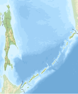
| Coordinates | 50°44′N 156°19′E / 50.733°N 156.317°E |
| Archipelago | Kuril Island |
| Area | 388 km2 (150 sq mi) |
| Length | 28 km (17.4 mi) |
| Width | 15 km (9.3 mi) |
| Highest elevation | 171 m (561 ft) |
| Administration | |
Russia | |
| Oblast | Sakhalin Oblast |
| District | Severo-Kurilsky |
| Demographics | |
| Population | ± 100 (seasonal) |
 | |
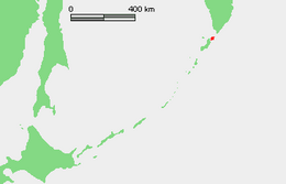
Shumshu (Russian: Шумшу, romanized: Shumshu; Japanese: 占守島, romanized: Shumushu-tō; Ainu: スㇺス (reconstruction), lit. 'good island') is the easternmost and second-northernmost island of the Kuril Islands chain, which divides the Sea of Okhotsk from the northwest Pacific Ocean. The name of the island is derived from the Ainu language, meaning "good island". It is separated from Paramushir by the very narrow Second Kuril Strait in the northeast 2.5 kilometres (1.6 mi), and its northern tip is 11 kilometres (6.8 mi), from Cape Lopatka at the southern tip of the Kamchatka Peninsula. The island has a seasonal population of around 100 inhabitants.
