This article may need to be rewritten to comply with Wikipedia's quality standards. (April 2017) |
This article needs additional citations for verification. (April 2017) |
Sihor
Shihor | |
|---|---|
town | |
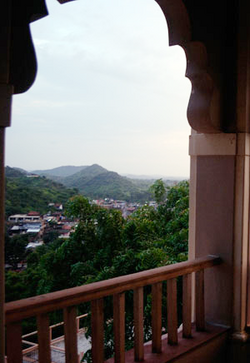
 View of a small portion of old Sihor town from Sukhnath with one of hill ranges in the surrounding | |
| Nickname(s): Saraswatpur, Sinhpur, Chhote Kashi | |
| Coordinates: 21°42′N 71°58′E / 21.7°N 71.97°E | |
| Country | |
| State | Gujarat |
| District | Bhavnagar |
| Elevation | 60 m (200 ft) |
| Population (2011) | |
• Total | 54,547 |
| Languages | |
| • Official | Gujarati, Hindi |
| Time zone | UTC+5:30 (IST) |
| PIN | 364240 |
| Vehicle registration | GJ-04 |
Sihor (Gujarati: સિહોર Sihor) is a town, a municipality in Bhavnagar district in the Indian state of Gujarat. Placed along the river Gautami, this erstwhile capital of the Gohil Rajputs, surrounded by hills is situated about 20 km from Bhavnagar. It becomes Sihor by corrupting its name from Saraswatpur, Sinhalpur, Sinhpur, Sinhor, and Shihor.
Regionally, Sihor is all-time famous and known for its hills, their rock pattern, Gautameshwar Mahadev & Lake, Sihor's Festivals, Navnath Pilgrimage (Navnath Yatra) of Shiva Temples, Brahma Kund, 'Sihori Rajwadi Penda' (Peda or chocolate cake), old town's ascends and descends, walled city and fort, narrow lanes, Nana Sahib Peshwa and the 1857 revolt, its food and delicacy, Copper-ware & Brass-ware, Pottery, snuff manufacturing factories, Rolling Mills and Industrial Plants.
Known as 'Saraswatpur' during Mahabharata period and 'Sinhpur', 'Sinhalpur' after that, locally in Gujarat, it is often regarded as 'Chhote Kashi' (sub-version or model of Kashi - Varanasi - Banaras) also. This may be due to numerous temples and Shivalayas in and around this medium-sized town, religious activities and resemblance of town's architecture in particular. The town exhibits a definite texture and architecture through a numerous ancient temples and buildings.
