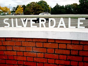
Silverdale | |
|---|---|
 Silverdale War Memorial | |
 | |
| Coordinates: 36°37′00″S 174°40′00″E / 36.6166642°S 174.666664°E | |
| Country | New Zealand |
| City | Auckland |
| Local authority | Auckland Council |
| Electoral ward | Albany ward |
| Local board | Hibiscus and Bays |
| Established | 1968 |
| Area | |
| • Land | 1,377 ha (3,403 acres) |
| Population (June 2023)[2] | |
| • Total | 1,780 |
| Postcode(s) | 0932 |
| Waiwera | Orewa | Millwater |
| Wainui |
|
Red Beach |
| Dairy Flat | Dairy Flat | Stanmore Bay |
Silverdale is a village approximately 30 km north of Auckland in the North Island of New Zealand. It is located on the north bank of the Weiti River and lies to the west of the Whangaparaoa Peninsula.
State Highway 1 passes to the west of the village via the Northern Motorway. The former route of State Highway 1 runs south-west to north-east through the village. This route was redesignated State Highway 17 before being redesignated Hibiscus Coast Highway (part of Urban Route 31). This passes through Orewa and Waiwera before joining State Highway 1 at the termination of the motorway south of Puhoi.
Hibiscus Coast busway station is the northernmost station participating in the Northern Busway. It is located on the Hibiscus Coast Highway a few hundred metres south-west of Silverdale.[3]
- ^ Cite error: The named reference
Areawas invoked but never defined (see the help page). - ^ "Population estimate tables - NZ.Stat". Statistics New Zealand. Retrieved 25 October 2023.
- ^ "What are the names and locations of the bus stations?". Auckland Transport – at.govt.nz. Retrieved 22 July 2017.