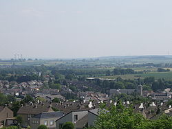
Simpelveld
Zumpelveld | |
|---|---|
 Skyline of Simpelveld | |
 Location in Limburg | |
| Coordinates: 50°50′N 5°59′E / 50.833°N 5.983°E | |
| Country | Netherlands |
| Province | Limburg |
| Government | |
| • Body | Municipal council |
| • Mayor | Richard de Boer (VVD) |
| Area | |
• Total | 16.03 km2 (6.19 sq mi) |
| • Land | 16.03 km2 (6.19 sq mi) |
| • Water | 0.00 km2 (0.00 sq mi) |
| Elevation | 138 m (453 ft) |
| Population (January 2021)[4] | |
• Total | 10,477 |
| • Density | 654/km2 (1,690/sq mi) |
| Demonym | Simpelvelter |
| Time zone | UTC+1 (CET) |
| • Summer (DST) | UTC+2 (CEST) |
| Postcode | 6350–6353, 6369 |
| Area code | 045 |
| Website | www |
Simpelveld (Dutch pronunciation: [ˈsɪmpəlˌvɛlt] ; Limburgish: Zumpelveld [ˈzʏm˦pəlˌvælt˦]) is a municipality and a town in the southeastern Netherlands. It is part of the municipal cooperative unit Parkstad Limburg.
Simpelveld is part of the Mergelland, named after the presence of chalk (mergel), hill country popular with tourists. The Mergellandroute passes through the town.
The population centre of Simpelveld has 28 national monuments, amongst which are the Oude Molen and the Saint Remigius Church. Simpelveld has a heritage railway station and is the home base of the South Limburg Railway Company. On one weekend in October there is a Day Out with Thomas from the children's television series Thomas and Friends.
- ^ "Burgemeester mr. R. (Richard) de Boer" [Mayor mr. R. (Richard) de Boer] (in Dutch). Gemeente Simpelveld. Retrieved 28 November 2013.
- ^ "Kerncijfers wijken en buurten 2020" [Key figures for neighbourhoods 2020]. StatLine (in Dutch). CBS. 24 July 2020. Retrieved 19 September 2020.
- ^ "Postcodetool for 6369AH". Actueel Hoogtebestand Nederland (in Dutch). Het Waterschapshuis. Retrieved 28 November 2013.
- ^ "Bevolkingsontwikkeling; regio per maand" [Population growth; regions per month]. CBS Statline (in Dutch). CBS. 1 January 2021. Retrieved 2 January 2022.

