| Disputed island | |
|---|---|
 Sin Cowe Island | |
| Other names | Sinh Ton Island Đảo Sinh Tồn (Vietnamese) Rurok Island (Philippine English) Pulo ng Rurok (Filipino) 景宏島 / 景宏岛 Jǐnghóng Dǎo (Chinese) |
| Geography | |
| Location | South China Sea |
| Coordinates | 09°53′07″N 114°19′47″E / 9.88528°N 114.32972°E |
| Archipelago | Spratly Islands |
| Administration | |
| District | Trường Sa District, Khánh Hòa |
| Commune | Sinh Tồn Commune |
| Claimed by | |
| Demographics | |
| Population | 31[citation needed] |

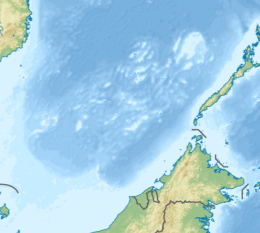
Sin Cowe Island 9°53′7″N 114°19′47″E / 9.88528°N 114.32972°E, also known as Sinh Ton Island[1] (Vietnamese: Đảo Sinh Tồn); Rurok Island (Filipino: Pulo ng Rurok, lit. 'Island of Peak'); Mandarin Chinese: 景宏島/景宏岛; pinyin: Jǐnghóng Dǎo, is an island in the Spratly Islands in the South China Sea. With an area of 8 hectares (20 acres), it is the seventh largest Spratly island and the third largest of those occupied by Vietnam. It has a fringing reef which is above water at low tide.[2]
This island has been controlled by Vietnam since 1974, first by South Vietnam's ARVN Navy, followed by the Navy of the Socialist Republic of Vietnam after 1975. The island is also claimed by China, the Philippines[3] and Taiwan.
It is part of the Union Banks.[4]

- ^ Valencia, Mark J.; Van Dyke, Jon M.; Ludwig, Noel A. (July 1999). Sharing the Resources of the West Philippine Sea. Honolulu: University of Hawaii Press. p. 31. ISBN 0824818814. Retrieved 6 June 2014.
- ^ Cole, Bernard (1 October 2001). The Great Wall at Sea: China's Navy Enters the Twenty-first Century (First ed.). U.S. Naval Institute Press. p. 207. ISBN 1557502390. Retrieved 6 June 2014.
- ^ Rosen, Mark E. (19 August 2014). "A CNA Occasional Paper - Philippine Claims in the South China Sea: A Legal Analysis". South China Sea: Facts and Legal Aspects. CNA Corporation’s Strategic Studies (CSS) division. Retrieved 16 September 2021.
The ubiquitous KIG claim by the Philippines carries little legal weight. It stands on the same footing as the nine-dashed-line claim. Also, it was made later than the claims of China, the ROC, and Vietnam.
- ^ "Digital Gazetteer of Spratly Islands". www.southchinasea.org. 19 August 2011. Retrieved 5 June 2014.
