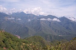
Sinaloa | |
|---|---|
| Free and Sovereign State of Sinaloa Estado Libre y Soberano de Sinaloa (Spanish) | |
 | |
| Nickname: The Land of the 11 Rivers | |
| Anthem: State of Sinaloa Anthem | |
 State of Sinaloa within Mexico | |
| Coordinates: 25°0′N 107°30′W / 25.000°N 107.500°W | |
| Country | |
| Capital and largest city | Culiacán Rosales |
| Largest metro | Greater Culiacán |
| Municipalities | 18 |
| Admission | 14 October 1830[1] |
| Order | 20th |
| Government | |
| • Governor | |
| • Senators[2] | |
| • Deputies[3] | |
| Area | |
• Total | 58,328 km2 (22,521 sq mi) |
| Ranked 17th | |
| Highest elevation | 2,815 m (9,236 ft) |
| Population (2020)[6] | |
• Total | 3,026,943 |
| • Rank | 16th |
| • Density | 52/km2 (130/sq mi) |
| • Rank | 18th |
| Demonym | Sinaloense |
| GDP | |
| • Total | MXN 668 billion (US$33.3 billion) (2022) |
| • Per capita | (US$10,840) (2022) |
| Time zone | UTC−7 (MST) |
| Postal code | 80-82 |
| Area code | |
| ISO 3166 code | MX-SIN |
| HDI | |
| Website | Official Web Site |
Sinaloa (Spanish pronunciation: [sinaˈloa] ), officially the Estado Libre y Soberano de Sinaloa (English: Free and Sovereign State of Sinaloa), is one of the 31 states which, along with Mexico City, comprise the Federal Entities of Mexico. It is divided into 18 municipalities, and its capital city is Culiacán Rosales.
It is located in northwest Mexico and is bordered by the states of Sonora to the north, Chihuahua and Durango to the east (separated from them by the Sierra Madre Occidental), and Nayarit to the south. To the west, Sinaloa faces Baja California Sur, across the Gulf of California. The state covers an area of 58,328 square kilometers (22,521 sq mi) and includes the islands of Palmito Verde, Palmito de la Virgen, Altamura, Santa María, Saliaca, Macapule, and San Ignacio. In addition to the capital city, the state's important cities include Mazatlán and Los Mochis.
- ^ "Ley. Reglas para la división del Estado de Sonora y Sinaloa" (in Spanish). Archived from the original on 17 October 2019. Retrieved 9 February 2010.
- ^ "Senadores por Sinaloa LXI Legislatura". Senado de la Republica. Archived from the original on 24 September 2015. Retrieved 6 April 2011.
- ^ "Listado de Diputados por Grupo Parlamentario del Estado de Sinaloa". Camara de Diputados. Archived from the original on 16 March 2012. Retrieved 6 April 2011.
- ^ "Resumen". Cuentame INEGI. Archived from the original on 14 May 2013. Retrieved 12 February 2013.
- ^ "Relieve". Cuentame INEGI. Archived from the original on 14 October 2010. Retrieved 6 April 2011.
- ^ "México en cifras". January 2016. Archived from the original on 18 July 2021. Retrieved 25 January 2021.
- ^ Citibanamex (13 June 2023). "Indicadores Regionales de Actividad Económica 2023" (PDF) (in Spanish). Retrieved 13 August 2023.
