| Singaling Hkamti | |||||||||
|---|---|---|---|---|---|---|---|---|---|
| State of the Shan States | |||||||||
| 1820–1948 | |||||||||
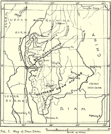
 1917 map of the Burmese Shan States with the two Hkamti enclaves in Upper Burma in the upper left corner | |||||||||
| Area | |||||||||
• 1901 | 2,546 km2 (983 sq mi) | ||||||||
| Population | |||||||||
• 1901 | 2,048 | ||||||||
| History | |||||||||
• State founded | 1820 | ||||||||
• Integrated into Burma | 1948 | ||||||||
| |||||||||
Singaling Hkamti (Burmese: ခန္တီးကလေး; Burmese: Kantigale; also known as Zingalein Kamti and Zingkaling Hkamti) was a Shan state in what is today Burma. It was an outlying territory, away from the main Shan State area. The state was located on both sides of the Chindwin River, in what is present-day Hkamti District, Sagaing Region. Its capital was Singaling Hkamti town.