Sirajganj District
সিরাজগঞ্জ জেলা | |
|---|---|
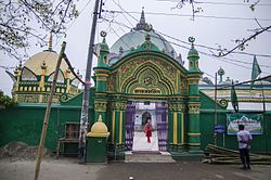
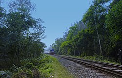
Clockwise from top-left: Shahzadpur Dargah Mosque, Jamuna Bridge, Hard Point, Jamuna Eco Park, Chalan Beel, China Barrage | |
| Nickname: The Gateway to North Bengal | |
 Location of Sirajganj District in Bangladesh | |
 Expandable map of Sirajganj District | |
| Coordinates: 24°20′N 89°37′E / 24.33°N 89.62°E | |
| Country | |
| Division | Rajshahi Division |
| Government | |
| • Deputy Commissioner | Dr. Farook Ahmed |
| Area | |
• Total | 2,402.02 km2 (927.43 sq mi) |
| Flood plain and Marsh land | |
| Elevation | 7 m (23 ft) |
| Population | |
• Total | 3,357,706 |
| • Density | 1,400/km2 (3,600/sq mi) |
| Demonym(s) | Sirajganji, Shirazgonji |
| Time zone | UTC+06:00 (BST) |
| Postal code | 6700 |
| Area code | 0751 |
| ISO 3166 code | BD-59 |
| HDI (2018) | 0.606[3] medium · 10th of 21 |
| Website | www |
Sirajganj District (Bengali: সিরাজগঞ্জ জেলা) is a district in the North Bengal region of Bangladesh, located in the Rajshahi Division.[4] It is the 25th largest district by area and 9th largest district by population in Bangladesh. It is known as the gateway to North Bengal.
Its administrative headquarter is Sirajganj. It is famous for its hand-loom cottage industries. In 1885, Sirajganj emerged as a thana. Formerly under Mymensingh District in Dacca Division, it was transferred to Pabna District on 15 February 1866.[5] It was upgraded to become a subdivision of Pabna in 1885. In 1984, it was upgraded to a district.
- ^ Population and Housing Census 2022 - District Report: Sirajganj (PDF). District Series. Dhaka: Bangladesh Bureau of Statistics. June 2024. ISBN 978-984-475-229-0.
- ^ Cite error: The named reference
2022censuswas invoked but never defined (see the help page). - ^ "Sub-national HDI - Area Database - Global Data Lab". hdi.globaldatalab.org. Retrieved 2020-03-18.
- ^ Kamrul Islam (2012). "Sirajganj District". In Sirajul Islam; Miah, Sajahan; Khanam, Mahfuza; Ahmed, Sabbir (eds.). Banglapedia: the National Encyclopedia of Bangladesh (Online ed.). Dhaka, Bangladesh: Banglapedia Trust, Asiatic Society of Bangladesh. ISBN 984-32-0576-6. OCLC 52727562. OL 30677644M. Retrieved 27 November 2024.
- ^ E M Lewis (1868). "Mymensingh District". Principal Heads of the History and Statistics of the Dacca Division. Calcutta: Calcutta Central Press Company. p. 213.


