Sirok | |
|---|---|
Village | |
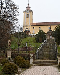
 Immaculate Conception church | |
| Coordinates: 47°55′52″N 20°11′45″E / 47.93111°N 20.19583°E | |
| Country | |
| County | Heves |
| District | Pétervására |
| First mentioned | 1302 |
| Government | |
| • Mayor | Gábor Tuza (Fidesz–KDNP) |
| Area | |
• Total | 63.39 km2 (24.48 sq mi) |
| Population (2022) | |
• Total | 1,625 |
| • Density | 26/km2 (66/sq mi) |
| Time zone | UTC+1 (CET) |
| • Summer (DST) | UTC+2 (CEST) |
| Postal code | 3332 |
| Area code | 36 |
| Website | www.sirok.hu |

Sirok is a village in Heves County, Hungary, in the Mátra mountain range, beside of the Tarna River. As of 2022 census, it has a population of 1625 (see Demographics). The village located 18.9 km from Eger, the capital of the county and beside of the (Nr. 84) Kisterenye–Kál-Kápolna railway line, 23.9 km from the main road 3 and 24.5 km from the M25 expressway. Kőkút is located 5.2 km southwest of the center of the village, which is an other inner area of 185 people with its own railway stop. Next to the road leading there is Sirok's own railway stop, 3.5 km from the center.[1] Although the settlement has its two own railway stops, public transport on the railway line ceased on 3 March 2007. The closest train station with public transport is in Eger 20.5 km away.
- ^ "Sirok". ksh.hu. Hungarian Central Statistical Office. Retrieved 31 January 2024.


