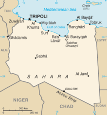
The Sirte Basin is a late Mesozoic and Cenozoic triple junction continental rift (extensional basin) along northern Africa that was initiated during the late Jurassic Period. It borders a relatively stable Paleozoic craton and cratonic sag basins along its southern margins. The province extends offshore into the Mediterranean Sea, with the northern boundary drawn at the 2,000 meter (m) bathymetric contour.[1] It borders in the north on the Gulf of Sidra and extends south into northern Chad.
- ^ "NPA Group - Oil and Mineral Study: Libya". Archived from the original on 2007-07-14. Retrieved 2007-09-12.