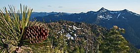
| Siskiyou Wilderness | |
|---|---|
 | |
| Location | Del Norte / Siskiyou / Humboldt counties, California, United States |
| Nearest city | Crescent City, California |
| Coordinates | 41°41′08″N 123°45′03″W / 41.68556°N 123.75083°W |
| Area | 182,802 acres (739.77 km2) |
| Established | 1984 |
| Governing body | U.S. Forest Service |
The Siskiyou Wilderness is a federal wilderness area designated by the passage of the California Wilderness Act of 1984. Originally, the land area was 153,000 acres (620 km2)[1] The Northern California Wild Heritage Act of 2006 added 30,122 acres (121.90 km2) for the current total of 182,802 acres (739.77 km2). All of the wilderness is in Northern California and is managed by the U.S. Forest Service. The wilderness spans three national forests: the Rogue River–Siskiyou, the Klamath, and the Six Rivers.
The Siskiyou Mountains form one of the longest continuous crests in the Klamath Mountains region. Elevations range from 770 feet (230 m) to the summit of Preston Peak at 7,309 feet (2,228 m) above sea level. Trending in a north–south direction from the Oregon border down to near the town of Weitchpec and 20 miles (32 km) inland from the Pacific Ocean, the Siskiyous are dotted by rocky peaks rising over 6,000 feet (1,800 m) from the surrounding lowlands.[2]
- ^ "California Wilderness Act of 1984" (PDF). p. 5.
- ^ Adkinson 2001, p. 292.
