| Siston Brook Clack Mill Brook | |
|---|---|
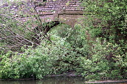
 Londonderry Wharf Bridge crossing the Siston Brook as it joins the Bristol Avon | |
 Diagrammatic map of the Siston Brook and tributaries in South Gloucestershire, England | |
| Location | |
| Country | England |
| Region | South Gloucestershire |
| Physical characteristics | |
| Source | |
| • location | Siston, South Gloucestershire, England |
| • coordinates | 51°28′48″N 2°26′55″W / 51.4799°N 2.4487°W |
| • elevation | 338 ft (103 m) |
| 2nd source | |
| • location | Siston, South Gloucestershire, England |
| • coordinates | 51°28′38″N 2°27′01″W / 51.4773°N 2.4503°W |
| • elevation | 305 ft (93 m) |
| Source confluence | |
| • location | Siston, South Gloucestershire, England |
| • coordinates | 51°28′28″N 2°26′52″W / 51.4744°N 2.4478°W |
| • elevation | 246 ft (75 m) |
| Mouth | River Avon |
• location | Londonderry Wharf, South Gloucestershire, England |
• coordinates | 51°25′36″N 2°29′18″W / 51.4268°N 2.4883°W |
• elevation | 35 ft (11 m) |
| Length | 6 mi (9.7 km) |
| Basin features | |
| Tributaries | |
| • right | Warmley Brook |
| River system | Bristol Avon |
Siston Brook rises in two separate streams which issue from a ridge just north of the village of Siston, South Gloucestershire, England. The brook is approximately 6 miles (9.7 km) long and is a tributary of the Bristol Avon. Much of its course is through the eastern suburbs of Bristol, although it remains outside the city boundaries. Tributaries include the Warmley Brook and an unnamed tributary from Bridgeyate.
The stream has provided power for watermills and battery mills in the past and some mill buildings still survive. Wildlife is supported by nature reserves through which the Siston Brook runs. Flooding has caused problems in the past, but modern measures to alleviate this include an attenuation reservoir and proposals to reinstate historic weirs and sluices. The name Siston is believed to derive from Anglo-Saxon, meaning Sige's Farmstead.