| Sittaung River | |
|---|---|
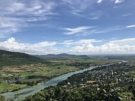
 Sittaung River near Pyinmana | |
 | |
| Native name | စစ်တောင်းမြစ် (Burmese) |
| Location | |
| Country | Myanmar, Bago Region |
| Physical characteristics | |
| Source | |
| • location | Shan Hills |
| Mouth | |
• location | Gulf of Mottama, Andaman Sea |
• coordinates | 16°57′54″N 96°59′15″E / 16.96500°N 96.98750°E |
• elevation | 0 m (0 ft) |
| Length | 420 kilometres (260 mi) |
| Discharge | |
| • average | 1,542 m3/s (54,500 cu ft/s) |
The Sittaung River (Burmese: စစ်တောင်းမြစ် [sɪʔ táʊɰ̃ mjɪʔ]; formerly, the Sittang or Sittoung[1]) is a river in south central Myanmar in Bago Division. The Pegu Range separates its basin from that of the Irrawaddy. The river originates at the edge of the Shan Hills southeast of Mandalay, and flows southward to the Gulf of Martaban. Its length is 420 kilometres (260 mi) and its mean annual discharge is around 50 cubic kilometres (12 cu mi) per year.