Skatval Municipality
Skatval herred | |
|---|---|
 View of the village of Skatval (front) and surrounding landscape as seen from Forbordsfjellet | |
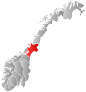
 Nord-Trøndelag within Norway | |
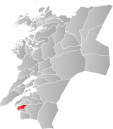
 Skatval within Nord-Trøndelag | |
| Coordinates: 63°30′39″N 10°48′59″E / 63.51083°N 10.81639°E | |
| Country | Norway |
| County | Nord-Trøndelag |
| District | Stjørdalen |
| Established | 1 Jan 1902 |
| • Preceded by | Nedre Stjørdal Municipality |
| Disestablished | 1 Jan 1962 |
| • Succeeded by | Stjørdal Municipality |
| Administrative centre | Skatval |
| Area (upon dissolution) | |
| • Total | 94 km2 (36 sq mi) |
| Population (1962) | |
| • Total | 1,944 |
| • Density | 21/km2 (54/sq mi) |
| Demonym | Skatvalsbygg[1] |
| Time zone | UTC+01:00 (CET) |
| • Summer (DST) | UTC+02:00 (CEST) |
| ISO 3166 code | NO-1715[2] |
Skatval is a former municipality in the old Nord-Trøndelag county, Norway. The 94-square-kilometre (36 sq mi) municipality existed from 1902 until its dissolution in 1962. The municipality encompassed the Skatval peninsula in the northwestern part of what is now the municipality of Stjørdal in Trøndelag county. The administrative centre was the village of Skatval where the Skatval Church is located. Other villages in the Skatval area include Auran, Kvithammer, and Steinvika.[3]


Skatval is divided in several geographical parts listed here counterclockwise from north: Langstein, Nordbygda, Sørbygda, Midtbygda, and Vassbygda. The Skatval peninsula is an important farming area, belonging to the plain districts of Trøndelag. The cultural landscape is dominated in the east by mountainous area with the highest being Forbordsfjellet at 596 metres (1,955 ft) above sea level. The mountaintop is a regional landmark.
- ^ "Navn på steder og personer: Innbyggjarnamn" (in Norwegian). Språkrådet.
- ^ Bolstad, Erik; Thorsnæs, Geir, eds. (26 January 2023). "Kommunenummer". Store norske leksikon (in Norwegian). Kunnskapsforlaget.
- ^ Askheim, Svein, ed. (13 December 2017). "Skatval". Store norske leksikon (in Norwegian). Kunnskapsforlaget. Retrieved 26 March 2018.