Skjerstad Municipality
Skjerstad kommune | |
|---|---|
 The village of Skjerstad, viewed from Skjerstad Church | |
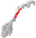
 Nordland within Norway | |
 Skjerstad within Nordland | |
| Coordinates: 67°07′01″N 15°00′04″E / 67.1170°N 15.0011°E | |
| Country | Norway |
| County | Nordland |
| District | Salten |
| Established | 1 Jan 1838 |
| • Created as | Formannskapsdistrikt |
| Disestablished | 1 Jan 2005 |
| • Succeeded by | Bodø Municipality |
| Administrative centre | Misvær |
| Government | |
| • Mayor (2003-2005) | Sissel Jakobsen (SV) |
| Area (upon dissolution) | |
| • Total | 465.4 km2 (179.7 sq mi) |
| • Rank | #216 in Norway |
| Highest elevation | 1,284.52 m (4,214.30 ft) |
| Population (2003) | |
| • Total | 1,030 |
| • Rank | #408 in Norway |
| • Density | 2.2/km2 (6/sq mi) |
| • Change (10 years) | |
| Demonym | Skjerstadværing[2] |
| Official language | |
| • Norwegian form | Bokmål |
| Time zone | UTC+01:00 (CET) |
| • Summer (DST) | UTC+02:00 (CEST) |
| ISO 3166 code | NO-1842[4] |
Skjerstad (Norwegian pronunciation: [ˈʂæ̀ːʂtɑ]) is a former municipality in Nordland county, Norway. The 465-square-kilometre (180 sq mi) municipality existed from 1838 until its dissolution in 2005. The area is now part of Bodø Municipality in the traditional district of Salten. The administrative centre was the village of Misvær. Another village in the municipality was the village of Skjerstad where Skjerstad Church was located. The municipality generally encompassed the area around the Misværfjorden, although it originally was much larger, also including the entire present-day Fauske Municipality.[5]
Prior to its dissolution in 2005, the 465-square-kilometre (180 sq mi) municipality was the 216th largest by area out of the 434 municipalities in Norway. Skjerstad Municipality was the 408th most populous municipality in Norway with a population of about 1,030. The municipality's population density was 2.2 inhabitants per square kilometre (5.7/sq mi) and its population had decreased by 15.8% over the previous 10-year period.[6][7]
- ^ "Høgaste fjelltopp i kvar kommune" (in Norwegian). Kartverket. 16 January 2024.
- ^ "Navn på steder og personer: Innbyggjarnamn" (in Norwegian). Språkrådet.
- ^ "Forskrift om målvedtak i kommunar og fylkeskommunar" (in Norwegian). Lovdata.no.
- ^ Bolstad, Erik; Thorsnæs, Geir, eds. (26 January 2023). "Kommunenummer". Store norske leksikon (in Norwegian). Kunnskapsforlaget.
- ^ Thorsnæs, Geir; Smith-Meyer, Trond, eds. (31 May 2016). "Skjerstad". Store norske leksikon (in Norwegian). Kunnskapsforlaget. Retrieved 16 September 2018.
- ^ Statistisk sentralbyrå. "Table: 06913: Population 1 January and population changes during the calendar year (M)" (in Norwegian).
- ^ Statistisk sentralbyrå (1 January 1951). Norges Sivile, Geistlige, Rettslige og Militære Inndeling 1. Januar 1951 (PDF). Norges Offisielle Statistikk (in Norwegian). Oslo, Norge: H. Aschehoug & Co.

