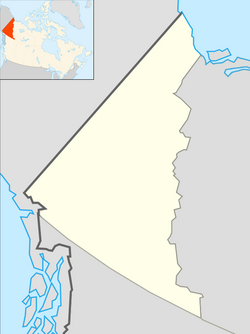
Snag | |
|---|---|
 Location east of Beaver Creek, Yukon | |
| Coordinates: 62°23′0″N 140°22′0″W / 62.38333°N 140.36667°W | |
| Country | Canada |
| Territory | Yukon |
| Population (2006) | |
| • Total | 0 (closed) |
| Time zone | UTC−07:00 (MST) |
| Area code | 867 |
Snag is a village located on a small, dry-weather sideroad off the Alaska Highway, 25 kilometres (16 mi) east of Beaver Creek, Yukon, Canada. The village of Snag is located in a bowl-shaped valley of the White River and its tributaries, including Snag Creek. It was first settled during the Klondike Gold Rush. An aboriginal village was also located approximately 8 kilometres (5 mi) away. It was the site of a military airfield, established as part of the Northwest Staging Route, which closed in 1968. In 1947, the village of Snag boasted a population of eight to ten First Nation people and fur traders. An additional staff of fifteen to twenty airport personnel — meteorologists, radio operators, aircraft maintenance men — lived at the airport barracks.


