| Sob Собь | |
|---|---|
 View of the Sob north of Kharp | |
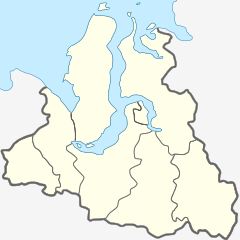
Mouth location in Yamalo-Nenets Autonomous Okrug, Russia | |
| Location | |
| Country | Russia |
| Physical characteristics | |
| Source | Polar Urals |
| • coordinates | 66°57′01″N 65°13′39″E / 66.95028°N 65.22750°E |
| Mouth | Ob |
• location | Katravozh |
• coordinates | 66°19′24″N 66°09′43″E / 66.32333°N 66.16194°E |
| Length | 185 km (115 mi) (304 km (189 mi)) |
| Basin size | 5,890 km2 (2,270 sq mi) |
| Discharge | |
| • average | 50 m3/s (1,800 cu ft/s) (88 km (55 mi) from the mouth) |
| Basin features | |
| Progression | Ob→ Kara Sea |
The Sob (Russian: Собь) is a river in Yamalo-Nenets Autonomous Okrug, Russia. The river is 185 kilometres (115 mi) long and has a catchment area of 5,890 square kilometres (2,270 sq mi).[1]
The Sob flows across the Priuralsky and Shuryshkarsky districts. The Salekhard–Igarka Railway stretch of the Northern Railway runs along the valley of the Sob in the Polar Urals. Since it is of relatively easy access, the river has become a tourist attraction as a Class I to IV destination for rafting and kayaking.[2]
- ^ "Река СОБЬ in the State Water Register of Russia". textual.ru (in Russian).
- ^ Река Собь - Ураловед
