Native name: Kuuganajuk | |
|---|---|
 Fury Beach, on the eastern shore of Somerset Island | |
 Somerset Island, Nunavut, Canada | |
Location in Nunavut | |
| Geography | |
| Location | Northern Canada |
| Coordinates | 73°15′N 93°30′W / 73.250°N 93.500°W[1] |
| Archipelago | Arctic Archipelago |
| Area | 24,786 km2 (9,570 sq mi) |
| Area rank | 46th |
| Highest elevation | 489 m (1604 ft) |
| Highest point | Creswell Peak |
| Administration | |
Canada | |
| Territory | Nunavut |
| Regions | Kitikmeot, Qikiqtaaluk |
| Demographics | |
| Population | Uninhabited |
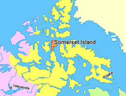
Somerset Island (Inuktitut Kuuganajuk) is a large, uninhabited island of the Arctic Archipelago, that is part of the Canadian territory of Nunavut. The island is separated from Cornwallis Island and Devon Island to the north by the Parry Channel, from Baffin Island to the east by Prince Regent Inlet, from the Boothia Peninsula to the south by Bellot Strait, and from Prince of Wales Island to the west by Peel Sound. It has an area of 24,786 km2 (9,570 sq mi), making it the 46th largest island in the world and Canada's twelfth largest island.[2]
The majority of the island lies in the Qikiqtaaluk Region and is home to the summer Arctic Watch Lodge. A small southern portion lies in the Kitikmeot Region and is the site of the former Fort Ross trading post.
- ^ "Somerset Island". Geographical Names Data Base. Natural Resources Canada.
- ^ "Atlas of Canada - Sea Islands". Atlas.nrcan.gc.ca. 2009-08-12. Archived from the original on 2013-01-22. Retrieved 2010-08-30.

