| Sonora Pass | |
|---|---|
 | |
| Elevation | 9,624 ft (2,933 m) |
| Traversed by | |
| Location | Mono / Tuolumne / Alpine counties, California, United States[1] |
| Range | Sierra Nevada |
| Coordinates | 38°19′40″N 119°38′9″W / 38.32778°N 119.63583°W |
Location in California | |
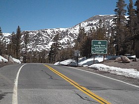
Sonora Pass (el. 9,624 ft. / 2,933 m.) is a mountain pass in the Sierra Nevada in California. It is the second-highest pass with a road in California and in the Sierra Nevada.[2] It is 321 feet (98 m) lower than Tioga Pass to the south.[3] State Route 108 traverses the pass, as does the Pacific Crest Trail.


- ^ "Sonora Pass, CA". USGS Quad maps. TopoQuest.com. Retrieved 2008-09-20.
- ^ "Highways and Major Roads Through the Sierra Nevada". Sierra Nevada Photos. Archived from the original on 2009-05-17. Retrieved 2008-09-20.
- ^ "Highways and Major Roads Through the Sierra Nevada". Sierra Nevada Photos. Archived from the original on 2009-05-17. Retrieved 2008-09-20.
