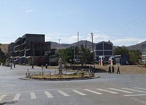
Sekota
ሰቆጣ Sokota, Sakota, &c. | |
|---|---|
Town | |
 | |
| Coordinates: 12°37′31″N 39°02′06″E / 12.62528°N 39.03500°E | |
| Country | Ethiopia |
| Region | Amhara |
| Zone | Wag Hemra Zone |
| Population (2007) | |
| • Total | 22,346 |
| Time zone | UTC+3 (EAT) |
Sekota, also spelled Sokota,[1] Sakota,[2] Soqota[3] (Amharic: ሰቆጣ; formerly ሰቈጣ) is a town and separate woreda in northern Ethiopia. The name is likely from the Agaw word sekut, "fortified village."[4] Located in the Wag Hemra Zone of the Amhara Region, Sekota has a latitude and longitude of 12°37′31″N 39°02′06″E / 12.62528°N 39.03500°E and an elevation of 2266 meters above sea level. It is surrounded by woreda of Soqota.
About 6 kilometers from Sekota is the church Wuqir Meskale Kristos, where the mummified corpses of several Wagshums lies.[5]
- ^ Cana, Frank Richardson (1911). . In Chisholm, Hugh (ed.). Encyclopædia Britannica. Vol. 1 (11th ed.). Cambridge University Press. p. 86.
- ^ National Geographic Globe (Map). 1 : 31,363,200. Washington, D.C.: National Geographic Society. 1965.
- ^ From its French spelling.
- ^ G.W.B. Huntingford, Historical Geography of Ethiopia from the first century AD to 1704 (London: British Academy, 1989), p. 176
- ^ Camerapix, Spectrum Guide to Ethiopia (New York: Interlink Books, 2000), p. 117


