Sorsogon | |
|---|---|
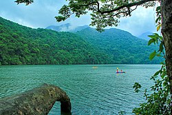
(from top: left to right) Lake Bulusan, Mount Bulusan, Sorsogon City, Barcelona church, Bulusan Volcano National Park, Sorsogon Provincial Capitol. | |
| Anthem: Marcha nin Sorsogon (Sorsogon March) | |
 Location in the Philippines | |
| Coordinates: 12°50′N 123°55′E / 12.83°N 123.92°E | |
| Country | Philippines |
| Region | Bicol Region |
| Founded | October 17, 1894[1][2] |
| Capital and largest city | Sorsogon City |
| Government | |
| • Type | Sangguniang Panlalawigan |
| • Governor | Jose Edwin B. Hamor (NPC) |
| • Vice Governor | Krunimar Antonio D. Escudero II (NPC) |
| • Legislature | Sorsogon Provincial Board |
| Area | |
• Total | 2,119.01 km2 (818.15 sq mi) |
| • Rank | 59th out of 81 |
| Highest elevation | 1,565 m (5,135 ft) |
| Population (2020 census)[4] | |
• Total | 828,655 |
| • Rank | 36th out of 81 |
| • Density | 390/km2 (1,000/sq mi) |
| • Rank | 15th out of 81 |
| Divisions | |
| • Independent cities | 0 |
| • Component cities | |
| • Municipalities | |
| • Barangays | 541 |
| • Districts | Legislative districts of Sorsogon |
| Time zone | UTC+8 (PHT) |
| ZIP Code | 4700–4715 |
| IDD : area code | +63 (0)56 |
| ISO 3166 code | PH-SOR |
| Spoken languages | |
| Website | www |
Sorsogon, officially the Province of Sorsogon (Bikol: Probinsya kan Sorsogon; Waray: Probinsya han Sorsogon; Tagalog: Lalawigan ng Sorsogon), is a province in the Philippines located in the Bicol Region. It is the southernmost province in the island of Luzon and is subdivided into fourteen municipalities (towns) and one city. Its capital (and largest city) is Sorsogon City (formerly the towns of Sorsogon and Bacon) and borders the province of Albay to the north.
Sorsogon is at the tip of the Bicol Peninsula and faces the island of Samar to the southeast across the San Bernardino Strait and Ticao Island to the southwest. Sorsoganons is how the people of Sorsogon call themselves.
- ^ History of Sorsogon[permanent dead link]. Official Website of the Government of Sorsogon. Retrieved on June 6, 2010
- ^ Sorsogon, Where Comes the World's Largest Fish Archived July 15, 2011, at the Wayback Machine. The Philippines Agribusiness Center. Retrieved on June 6, 2010.
- ^ "Province: Sorsogon". PSGC Interactive. Quezon City, Philippines: Philippine Statistics Authority. Retrieved January 8, 2016.
- ^ Census of Population (2020). "Region V (Bicol Region)". Total Population by Province, City, Municipality and Barangay. Philippine Statistics Authority. Retrieved July 8, 2021.


