| Souss-Massa | |
|---|---|
 The Oued Massa at the center of the park | |
| Location | Morocco |
| Coordinates | 30°04′30″N 9°40′12″W / 30.075°N 9.670°W |
| Area | 338 km2 (131 sq mi) |
| Established | 1991 |
| Official name | Zones humides de Souss-Massa |
| Designated | 15 January 2005 |
| Reference no. | 1487[1] |
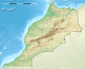
The Souss-Massa National Park (Parc National de Souss-Massa) is a 33,800 hectare national park on the Atlantic coast of Morocco which was created in 1991. It lies between Agadir to the north and Sidi Ifni to the south. The estuary of the Oued Souss is the northern limit of the park, the Oued Massa is near the center, and at the southern end is the town of Aglou. 30,000 ha of land near Aglou, south of the park, is also included in the site because it is sometimes used as a feeding area by the northern bald ibis. The habitat is grazed steppe with dunes, beaches and wetlands. The soil is mainly sandy with some rockier areas.[2]
- ^ "Zones humides de Souss-Massa". Ramsar Sites Information Service. Archived from the original on 5 July 2019. Retrieved 25 April 2018.
- ^ "Parc National de Souss-Massa and Aglou". BirdLife IBA Factsheet. BirdLife International. Archived from the original on 4 June 2011. Retrieved 13 November 2008.
