South Lake Union, Seattle | |
|---|---|
 South Lake Union neighborhood, viewed from south of Denny Way | |
| Nicknames: SLU | |
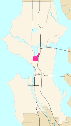
 South Lake Union Highlighted in Pink | |
| Coordinates: 47°37′28″N 122°19′54″W / 47.62444°N 122.33167°W | |
| Country | United States |
| State | Washington |
| County | King |
| City | Seattle |
| Zip Code | 98109 |
| Area Code | 206 |
South Lake Union (sometimes SLU[1][2]) is a neighborhood in central Seattle, Washington, so named because it is at the southern tip of Lake Union.
The official boundaries of the City of Seattle Urban Center are Denny Way on the south, beyond which is Denny Triangle; Interstate 5 on the east, beyond which is Capitol Hill; Aurora Avenue N. (State Route 99) and 7th Avenue N. on the west, beyond which is Lower Queen Anne; and Galer Street, Lake Union, and E. Newton Place on the north, beyond which are Westlake and Eastlake,[3] but like most Seattle neighborhoods, its precise boundaries are indeterminate. In particular Cornish College of the Arts and Vulcan Inc. properties such as 2200 and 2201 Westlake are officially in Denny Triangle for city planning and zoning purposes but often referred to as South Lake Union.[4] The portion of South Lake Union east of Fairview Avenue N. is historically known as Cascade. Historic structures continue to stand in the Cascade neighborhood today.
Its main thoroughfares are Valley and Mercer Streets (east- and westbound) and Dexter, 9th, Westlake, and Fairview Avenues N. and Eastlake Avenue E. (north- and southbound). The city addressed transportation issues by changing Mercer Street into a two-way, six-lane, tree-lined boulevard, with Valley Street becoming a two-way, pedestrian friendly road.[5]
- ^ Adriana Grant, Portage Bay Cafe to Open a Second Location in SLU Archived 2011-07-24 at the Wayback Machine, Voracious (Seattle Weekly food blog), April 7, 2008. Accessed online 8 December 2008.
- ^ The SLU story Archived 2011-07-17 at the Wayback Machine, Vulcan Real Estate. Accessed online 8 December 2008.
- ^ Seattle Department of Planning and Development, South Lake Union Neighborhood Plan Archived 2010-06-07 at the Wayback Machine
- ^ Pryne, Eric (2010-04-29). "Federal agencies moving in". Seattle Times. Retrieved May 2, 2010.
- ^ Seattle Department of Transportation, Mercer Corridor Project