South Malabar | |
|---|---|
Geographical / Historical Area | |
|
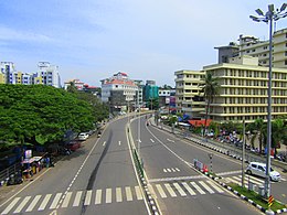
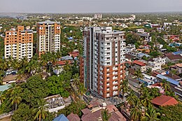
Top to bottom: Kozhikode metropolitan area, Malappuram metropolitan area, and Palakkad city view from Kunnathurmedu. | |
| Country | |
| State | Kerala |
| Government | |
| • Body | Government of Kerala |
| Area | |
• Total | 7,416 km2 (2,863 sq mi) |
| Population (2011)(approx.)[1] | |
• Total | 8,368,794 |
| • Density | 1,128/km2 (2,920/sq mi) |
| Languages | |
| • Official | Malayalam |
| Time zone | UTC+5:30 (IST) |
| PIN | 673***, 676***, 678***, 679*** and 680*** |
| ISO 3166 code | IN-KL |
| Vehicle registration | KL-08, KL-09, KL-10, KL-11, KL-46, KL-49, KL-50, KL-51, KL-52, KL-53, KL-54, KL-55, KL-57, KL-65, KL-71, KL-75, KL-76, KL-77, KL-84 & KL-85 |
| Niyamasabha constituencies | 36[2] |
South Malabar refers to a geographical area of the southwestern coast of India covering some parts of the present-day Kerala state. South Malabar covers the regions included in present-day Kozhikode taluk of Kozhikode district, Wayanad district excluding Mananthavady taluk, the whole area of Malappuram district, Chavakkad taluk of Thrissur district, and Palakkad district, excluding parts of Chittur taluk. The Fort Kochi region of Kochi city also historically belongs to South Malabar. The term South Malabar refers to the region of the erstwhile Malabar District south to the river Korapuzha, and bears a high cultural similarity to both the Cochin (Southern Thrissur region) and the North Malabar regions.[3]
Under British rule, South Malabar's chief importance lay in producing coconut, pepper, and tiles.[4] Old administrative records of the erstwhile Madras Presidency recorded that the most remarkable plantation owned by the government in the Madras Presidency was the teak plantation at Nilambur, planted in 1844.[5] South Malabar held importance as one of the two districts in the Madras Presidency that lay on the western Malabar Coast, thus accessing the marine route through the Arabian Sea via its ports at Beypore and Fort Kochi. The first railway line of Kerala, from Tirur to Beypore, was laid for it.
Kozhikode is the capital and largest city of the whole of Malabar, followed by Palakkad. The South Malabar region is bounded by North Malabar (Korapuzha) to north, the hilly region of Nilgiris and Palakkad Gap which connects Coimbatore to east, Cochin to south, and Arabian Sea to west.[6] The historical regions of Nediyiruppu Swaroopam, Eranad, Valluvanad, Parappanad, Kavalappara, Vettathunadu, the Nilambur Kingdom, Nedungadis, and Palakkad, are all included in South Malabar. The longest three rivers of Malabar region, namely the Bharathappuzha, Chaliyar, and Kadalundi Rivers, flow through South Malabar.
- ^ "District Census Handbooks of Kerala - 2011". censusindia.gov.in. Retrieved 26 July 2020.
- ^ "Limits of assembly constituencies of Kerala" (PDF). Keralaassembly.org. Retrieved 26 July 2020.
- ^ Logan, William (2010). Malabar Manual (Volume-I). New Delhi: Asian Educational Services. ISBN 9788120604476.
- ^ Pamela Nightingale, ‘Jonathan Duncan (bap. 1756, d. 1811)’, Oxford Dictionary of National Biography, Oxford University Press, 2004; online edn, May 2009
- ^ Boag, GT (1933). The Madras Presidency (1881-1931) (PDF). Madras: Government of Madras. p. 63.
- ^ Government of Madras (1953). 1951 Census Handbook- Malabar District (PDF). Madras Government Press.


