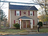
South Pottstown | |
|---|---|
 Flooding in South Pottstown | |
 Location in Chester County and the U.S. state of Pennsylvania. | |
| Coordinates: 40°14′11″N 75°39′26″W / 40.23639°N 75.65722°W | |
| Country | United States |
| State | Pennsylvania |
| County | Chester |
| Township | North Coventry |
| Area | |
| • Total | 1.6 sq mi (4 km2) |
| • Land | 1.5 sq mi (4 km2) |
| • Water | 0.1 sq mi (0.3 km2) |
| Elevation | 141 ft (43 m) |
| Population (2010) | |
| • Total | 2,081 |
| • Density | 1,300/sq mi (500/km2) |
| Time zone | UTC-5 (EST) |
| • Summer (DST) | UTC-4 (EDT) |
| ZIP code | 19465 [1] |
| Area code(s) | 610, 484, & 835 |

South Pottstown is a community in North Coventry Township, Chester County in the U.S. state of Pennsylvania. It is defined by the U.S. Census Bureau as a census-designated place (CDP) for statistical purposes and does not have any legal status as a separately incorporated municipality. It is a part of the Pottstown urban area. The population was 2,081 at the 2010 census.