| Southeast Metro Manila Expressway | |
|---|---|
| Skyway Stage 4 C6 Expressway | |
 | |
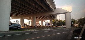
 Construction along Carlos P. Garcia Avenue (C-5) in Taguig as of August 2022 | |
| Route information | |
| Maintained by SMC Skyway Stage 4 Corporation[1] | |
| Length | 32.664 km[2] (20.296 mi) |
| Component highways | |
| Major junctions | |
| South end | |
| North end | Batasan Road in Quezon City |
| Location | |
| Country | Philippines |
| Major cities | |
| Towns | |
| Highway system | |
| |
The Southeast Metro Manila Expressway (SEMME), also known as Skyway Stage 4, C-6 Expressway and formerly as Metro Manila Expressway, is an on-hold[5][6] 32.664-kilometer (20.296 mi)[2] tolled expressway running across eastern Metro Manila and western Rizal. The expressway will help decongest the existing roadways across Metro Manila, such as EDSA and Circumferential Road 5. The expressway is part of the larger Circumferential Road 6 project. Which it's expansion from original C-6 length currently passing from General Santos Avenue in Taguig up to Highway 2000 (Phase 1) in Taytay, will expand to Cainta, Pasig, Marikina, San Mateo, and in Quezon City.
The expressway will begin at the Skyway near FTI (now Arca South), Taguig, and will end at the Batasang Pambansa Complex in Quezon City. It will also connect to the North Luzon Expressway (NLEx) in Balagtas, Bulacan.[7]

The entire expressway will be a spur component of Expressway 2 (E2) of the Philippine expressway network.
- ^ "PART I – BUSINESS AND GENERAL INFORMATION" (PDF). San Miguel Corporation. Archived from the original (PDF) on April 30, 2021. Retrieved April 30, 2021.
- ^ a b "SOUTHEAST METRO MANILA EXPRESSWAY (C6) PROJECT". Department of Public Works and Highways. Retrieved February 24, 2021.
- ^ "Road and Bridge Inventory". Department of Public Works and Highways. Retrieved January 31, 2021.
- ^ "NCR". Department of Public Works and Highways. Retrieved January 31, 2021.
- ^ Camus, Miguel R. (January 8, 2018). "SMC's South East Metro Manila Expressway project begins". Inquirer.net. Retrieved May 5, 2018.
- ^ Dela Paz, Chrisee (January 8, 2018). "San Miguel to start building Southeast Metro Manila Expressway in April". Rappler. Retrieved May 5, 2018.
- ^ "DOTr break ground on South East Metro Manila Expressway project". CNN Philippines. January 8, 2018. Archived from the original on February 14, 2019. Retrieved January 18, 2018.
