This article has multiple issues. Please help improve it or discuss these issues on the talk page. (Learn how and when to remove these messages)
|
Southern California Logistics Airport | |||||||||||||||
|---|---|---|---|---|---|---|---|---|---|---|---|---|---|---|---|
 | |||||||||||||||
 Aerial photo taken July 2009 | |||||||||||||||
| Summary | |||||||||||||||
| Airport type | Public | ||||||||||||||
| Operator | United States Air Force | ||||||||||||||
| Serves | Victorville, California | ||||||||||||||
| Elevation AMSL | 2,885 ft / 879 m | ||||||||||||||
| Coordinates | 34°35′51″N 117°22′59″W / 34.59750°N 117.38306°W | ||||||||||||||
| Website | Official website | ||||||||||||||
| Maps | |||||||||||||||
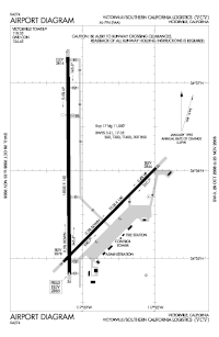
 FAA airport diagram | |||||||||||||||
 | |||||||||||||||
| Runways | |||||||||||||||
| |||||||||||||||
Southern California Logistics Airport (IATA: VCV, ICAO: KVCV, FAA LID: VCV), also known as Victorville Airport, is a public airport located in the city of Victorville in San Bernardino County, California, approximately 50 mi (80 km) north of San Bernardino. Prior to its civil usage, the facility was George Air Force Base, from 1941 to 1992 a United States Air Force flight training facility.
The airport is home to Southern California Aviation, a large transitional facility for commercial aircraft.[1]
As a logistics airport, it is designed for business, military, and freight use. There are no commercial passenger services at this facility except for FBO and charter flights.
- ^ Pae, P. (15 March 2009). "As travel declines, aircraft 'boneyard' in Victorville fills up". The Los Angeles Times. Retrieved 21 January 2011.