Southwold, Ontario | |
|---|---|
| Township of Southwold | |
 | |
| Coordinates: 42°45′N 81°19′W / 42.750°N 81.317°W | |
| Country | Canada |
| Province | Ontario |
| County | Elgin |
| Incorporated | 1852 |
| Government | |
| • Mayor | Grant Jones |
| • Federal riding | Elgin—Middlesex—London |
| • Prov. riding | Elgin—Middlesex—London |
| Area | |
| • Land | 301.74 km2 (116.50 sq mi) |
| Population (2016)[1] | |
• Total | 4,421 |
| • Density | 14.7/km2 (38/sq mi) |
| Time zone | UTC-5 (EST) |
| • Summer (DST) | UTC-4 (EDT) |
| Postal Code | N0L |
| Area code(s) | 519, 226, 548 |
| Website | www.southwold.ca |
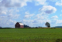
Southwold is a township in Elgin County, in Ontario, Canada, located on the north shore of Lake Erie. It is a rich agricultural zone producing predominantly corn and soybeans. It is part of the London census metropolitan area.
- ^ a b "Census Profile, 2016 Census: Southwold, Township". Statistics Canada. 8 February 2017. Retrieved June 11, 2019.
