Spiringen | |
|---|---|
 | |
| Coordinates: 46°52′N 8°44′E / 46.867°N 8.733°E | |
| Country | Switzerland |
| Canton | Uri |
| District | n.a. |
| Area | |
| • Total | 64.68 km2 (24.97 sq mi) |
| Elevation | 923 m (3,028 ft) |
| Population (31 December 2018)[2] | |
| • Total | 849 |
| • Density | 13/km2 (34/sq mi) |
| Time zone | UTC+01:00 (Central European Time) |
| • Summer (DST) | UTC+02:00 (Central European Summer Time) |
| Postal code(s) | 6464 |
| SFOS number | 1218 |
| ISO 3166 code | CH-UR |
| Surrounded by | Bürglen, Glarus Süd (GL), Muotathal (SZ), Schattdorf, Unterschächen[3] |
| Website | www SFSO statistics |
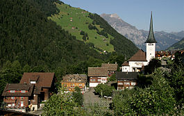
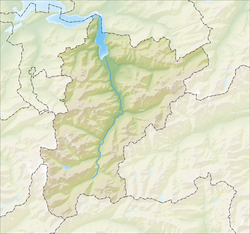
Spiringen is a village and a municipality in the canton of Uri in Switzerland. The municipality comprises two disjoint areas, separated by the municipality of Unterschächen and the Klausen Pass. The western area includes the village of Spiringen in the Schächen Valley, whilst the eastern area includes the Urner Boden alp above Linthal and the canton of Glarus.[3]
- ^ a b "Arealstatistik Standard - Gemeinden nach 4 Hauptbereichen". Federal Statistical Office. Retrieved 13 January 2019.
- ^ "Ständige Wohnbevölkerung nach Staatsangehörigkeitskategorie Geschlecht und Gemeinde; Provisorische Jahresergebnisse; 2018". Federal Statistical Office. 9 April 2019. Retrieved 11 April 2019.
- ^ a b map.geo.admin.ch (Map). Swiss Confederation. Retrieved 21 April 2015.


