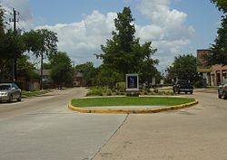
Spring Branch East/West | |
|---|---|
Houston, Texas, neighborhood | |
 | |
 | |
| Coordinates: 29°48′58″N 95°31′04″W / 29.81611°N 95.517719°W | |
| Elevation | 26 m (85 ft) |
| Population | |
| • Total | 134,225 |
| Time zone | UTC-6 (CST) |
| • Summer (DST) | UTC-5 (CDT) |
| ZIP codes[2] | 77080, 77041, 77043, 77055 |
| Website | sbmd |
Spring Branch is a district in west-northwest Harris County, Texas, United States, roughly bordered by Tanner Road and Hempstead Road to the north, Beltway 8 to the west, Interstate 10 to the south, and the 610 Loop to the east; it is almost entirely within the city of Houston.[4] Established by the Texas Legislature, the Spring Branch Management District exercises jurisdiction over the area.
Several minor bayous run through the community, including Brickhouse Gully, Spring Branch (the neighborhood namesake), and Briar Branch, which drain into Buffalo Bayou in central Houston. Spring Lake is a large pond near the center of the neighborhood.
Spring Branch includes significant immigrant Korean American and Hispanic American communities,[5] and was established in the 1800s as a rural German American community. As of 2020 Spring Branch East/West population has grown by 7,298 residents and over 400 new construction homes built.
- ^ "Spring Branch, Houston, TX Demographics". AreaVibes. Retrieved February 14, 2014.
- ^ "Spring Branch District Maps: Zip Codes (PDF)" (PDF). sbmd.org. Retrieved February 14, 2014.[permanent dead link]
- ^ "Elevation of 29.81611, -95.517719". VeloRoutes. Retrieved February 14, 2014.
- ^ "Spring Branch District Maps: District Map (PDF)" (PDF). sbmd.org. October 2012. Archived from the original on March 26, 2016. Retrieved March 26, 2016.
{{cite web}}: CS1 maint: bot: original URL status unknown (link) () - ^ Lomax, John Nova. "The Seoul of Houston: The Weather Was Not the Strong Point on Long Point." Houston Press. January 30, 2008.