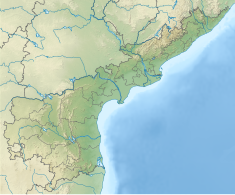
| Srisailam Dam | |
|---|---|
 | |
| Location | Sri Sailam, Nandyal district, Andhra Pradesh, India Domalapenta, Nagarkurnool district, Telangana, India |
| Coordinates | 16°05′13″N 78°53′50″E / 16.08694°N 78.89722°E |
| Purpose | Hydroelectric, Irrigation & Water supply |
| Construction began | 1960 |
| Opening date | 1981 |
| Construction cost | ₹10 billion[citation needed] |
| Owner(s) | Government of Andhra Pradesh |
| Dam and spillways | |
| Type of dam | Gravity & Masonry dam |
| Impounds | Krishna River |
| Height | 145.10 m (476 ft)[1][2] |
| Length | 512 m (1,680 ft) |
| Spillway capacity | 38369 cumecs |
| Reservoir | |
| Creates | Srisailam Reservoir (Neelam Sanjeevareddy Sagar) |
| Total capacity | 216 Tmcft |
| Catchment area | 206,040 km2 (79,550 sq mi) |
| Surface area | 616 km2 (238 sq mi) |
| Power Station | |
| Operator(s) | APGENCO(right bank) and TGGENCO(left bank) |
| Turbines | 6 × 150 MW (200,000 hp) reversible Francis-type (left bank) 7 × 110 MW (150,000 hp) Francis type (right bank) |
| Installed capacity | 1,670 MW (2,240,000 hp) |
The Srisailam Dam is constructed across the Krishna River in Nandyal district, Andhra Pradesh and Nagarkurnool district, Telangana near Srisailam temple town and is the 2nd largest capacity working hydroelectric station in India.[3]
The dam was constructed in a deep gorge in the Nallamala Hills in between Nandyal and Nagarkurnool districts, 300 m (980 ft) above sea level. It is 512 m (1,680 ft) long, 145 metres (476 ft) maximum height and has 12 radial crest gates. It has a reservoir of 616 square kilometres (238 sq mi). The project has an estimated live capacity to hold 178.74 Tmcft at its full reservoir level of 885 feet (270 m) MSL. Its gross storage capacity is 6.116 cubic km (216 tmc ft). The minimum draw-down level (MDDL) of the reservoir is at 705 feet (215 m) MSL from its river sluice gates, and corresponding dead storage is 3.42 Tmcft.[4] The left bank underground power station houses 6 × 150 megawatts (200,000 hp) reversible Francis-pump turbines for pumped-storage operation (each turbine can pump 200 cumecs) and the right bank semi-underground power station houses 7 × 110 megawatts (150,000 hp) Francis-turbine generators.
Tail pond dam/weir located 14 km downstream of Srisailam dam is under advanced stage of construction to hold the water released by the hydro turbines and later pump back into the Srisailam reservoir by operating the turbines in pump mode.[5] The weir portion got breached in November 2015 unable to withstand the normal water release from the hydropower stations.[6] Tail pond weir was completed during the year 2017 and pumping mode operation is being done even when the downstream Nagarjuna Sagar reservoir water level is below 531.5 feet (162 m) MSL. The tail pond has nearly 1 tmcft live storage capacity.[7]
- ^ "India: National Register of Large Dams 2009" (PDF). Central Water Commission. Archived from the original (PDF) on 21 July 2011. Retrieved 10 July 2011.
- ^ Jauhari, V.P. (2005). Sustaining river linking. New Delhi, India: Mittal Publications. p. 84. ISBN 817099991X.
- ^ "Srisailam (N.S.R.S.P) Dam D00557". Retrieved 22 September 2015.
- ^ "Neelam Sanjeeva Reddy Srisailam Project". Archived from the original on 25 September 2017. Retrieved 22 September 2017.
- ^ "Srisailam Tail pond Dam". Archived from the original on 11 July 2018. Retrieved 22 December 2015.
- ^ "Srisailam Tail pond Dam leaked". YouTube. Archived from the original on 11 March 2016. Retrieved 22 December 2015.
- ^ "Srisailam dam tail pond level and storage capacity" (PDF). Retrieved 22 September 2015.
