St. Clair Township, Pennsylvania | |
|---|---|
 The Laurel Hill Furnace, a historic landmark in St. Clair Township | |
 Map of Westmoreland County, Pennsylvania Highlighting St. Clair Township | |
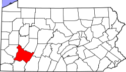
 Map of Pennsylvania highlighting Westmoreland County | |
| Country | United States |
| State | Pennsylvania |
| County | Westmoreland |
| Settled | 1776 |
| Incorporated | 1856 |
| Area | |
• Total | 28.41 sq mi (73.58 km2) |
| • Land | 28.14 sq mi (72.88 km2) |
| • Water | 0.27 sq mi (0.71 km2) |
| Population | |
• Total | 1,339 |
• Estimate (2021)[2] | 1,328 |
| • Density | 51.85/sq mi (20.02/km2) |
| Time zone | UTC-5 (Eastern (EST)) |
| • Summer (DST) | UTC-4 (EDT) |
| Area code(s) | 724, 814 |
| FIPS code | 42-129-67240 |
St. Clair Township is a township in Westmoreland County, Pennsylvania, United States. The population was 1,339 at the 2020 census.[2] It is also one of three communities within the county to utilise the 814 area code, alongside New Florence and Seward.
- ^ "2016 U.S. Gazetteer Files". United States Census Bureau. Retrieved August 14, 2017.
- ^ a b c Bureau, US Census. "City and Town Population Totals: 2020—2021". Census.gov. US Census Bureau. Retrieved July 26, 2022.
{{cite web}}:|last1=has generic name (help)