St. Francis, South Dakota
Sápauŋ thí | |
|---|---|
 St. Charles Borromeo Catholic Church in St. Francis | |
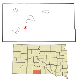
 Location in Todd County and the state of South Dakota | |
| Coordinates: 43°08′33″N 100°54′10″W / 43.14250°N 100.90278°W | |
| Country | United States |
| State | South Dakota |
| County | Todd |
| Area | |
• Total | 0.36 sq mi (0.94 km2) |
| • Land | 0.36 sq mi (0.94 km2) |
| • Water | 0.00 sq mi (0.00 km2) |
| Elevation | 3,002 ft (915 m) |
| Population | |
• Total | 469 |
| • Density | 1,295.58/sq mi (500.08/km2) |
| Time zone | UTC-6 (Central (CST)) |
| • Summer (DST) | UTC-5 (CDT) |
| Area code | 605 |
| FIPS code | 46-57140[4] |
| GNIS feature ID | 1267558[2] |
St. Francis, also known as Sápauŋ thí [5](Lakota: Sápauŋ thí; "Catholic House") is a town in the Rosebud Indian Reservation in Todd County, South Dakota, United States. The population was 469 at the 2020 census.[6]
St. Francis is named after the St. Francis Indian School, which was named after Francis of Assisi and was operated by the Catholic Franciscan order.[7]
- ^ "ArcGIS REST Services Directory". United States Census Bureau. Retrieved October 15, 2022.
- ^ a b U.S. Geological Survey Geographic Names Information System: St. Francis, South Dakota
- ^ Cite error: The named reference
USCensusDecennial2020CenPopScriptOnlywas invoked but never defined (see the help page). - ^ "U.S. Census website". United States Census Bureau. Retrieved January 31, 2008.
- ^ Ullrich, Jan F. (2014). New Lakota Dictionary (2nd ed.). Bloomington, IN: Lakota Language Consortium. ISBN 978-0-9761082-9-0.
- ^ "U.S. Census Bureau: St. Francis town, South Dakota". www.census.gov. United States Census Bureau. Retrieved December 22, 2021.
- ^ Federal Writers' Project (1940). South Dakota place-names, v.1-3. University of South Dakota. p. 60.