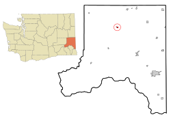
St. John | |
|---|---|
| St. John, Washington | |
 | |
 Location of St. John, Washington | |
| Coordinates: 47°5′25″N 117°34′56″W / 47.09028°N 117.58222°W | |
| Country | United States |
| State | Washington |
| County | Whitman |
| Area | |
• Total | 0.67 sq mi (1.74 km2) |
| • Land | 0.67 sq mi (1.74 km2) |
| • Water | 0.00 sq mi (0.00 km2) |
| Elevation | 1,962 ft (598 m) |
| Population (2020) | |
• Total | 599 |
| • Density | 890/sq mi (340/km2) |
| Time zone | UTC-8 (Pacific (PST)) |
| • Summer (DST) | UTC-7 (PDT) |
| ZIP code | 99171 |
| Area code | 509 |
| FIPS code | 53-60860[2] |
| GNIS feature ID | 1508016[3] |
| Website | Town of St. John |
St. John is a town in Whitman County, Washington, United States. The population was 599 at the 2020 census.[4] St. John is the birthplace of the twentieth governor of Washington, Mike Lowry.
- ^ "2019 U.S. Gazetteer Files". United States Census Bureau. Retrieved August 7, 2020.
- ^ "U.S. Census website". United States Census Bureau. Retrieved January 31, 2008.
- ^ "US Board on Geographic Names". United States Geological Survey. October 25, 2007. Retrieved January 31, 2008.
- ^ "Census Bureau profile: St. John, Washington". United States Census Bureau. May 2023. Retrieved May 11, 2024.