Saint Louis County | |
|---|---|
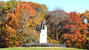
 Babler State Park, the largest of three state parks in St. Louis County | |
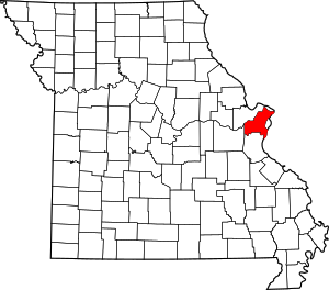
 Location within the U.S. state of Missouri | |
 Missouri's location within the U.S. | |
| Coordinates: 38°38′N 90°26′W / 38.64°N 90.44°W | |
| Country | |
| State | |
| Founded | October 1, 1812 |
| Seat | Clayton |
| Largest city | Florissant |
| Government | |
| • County executive | Sam Page (D) |
| Area | |
• Total | 523 sq mi (1,350 km2) |
| • Land | 508 sq mi (1,320 km2) |
| • Water | 15 sq mi (40 km2) 2.9% |
| Population (2020) | |
• Total | 1,004,125 |
• Estimate (2023) | 987,059 |
| • Density | 1,900/sq mi (740/km2) |
| Time zone | UTC−6 (Central) |
| • Summer (DST) | UTC−5 (CDT) |
| Congressional districts | 1st, 2nd |
| Website | stlouiscountymo |
St. Louis County is located in eastern Missouri. It is bounded by the City of St. Louis and the Mississippi River to the east, the Missouri River to the north, and the Meramec River to the south. At the 2020 census, the total population was 1,004,125,[1] making it the most populous county in Missouri. Its county seat is Clayton.[2] The county is included in the St. Louis, MO–IL metropolitan statistical area.
After Great Britain took over former French territory east of the Mississippi River, many ethnic French colonists moved west. They settled the area of St. Louis County and founded the city of St. Louis in the late 1700s. The US acquired this territory in 1803 with the Louisiana Purchase.
In 1877 residents of the City of St. Louis voted to separate from the county and become an independent city. In the 1960s, with growing suburban development of Greater St. Louis, the county's population overtook that of the city for the first time. Restructuring of industry resulted in job and population declines in the city, and the county has continued to expand.
Through the decades changing conditions have led many business and political leaders to propose merging the city and county as a single government. In 2019, efforts to put the issue to a statewide vote failed to get on a ballot.[3]
- ^ "State & County QuickFacts". United States Census Bureau. Retrieved October 24, 2022.
- ^ "Find a County". National Association of Counties. Retrieved June 7, 2011.
- ^ Kohler, Jeremy; Hunn, David (January 29, 2019). "'Metro City': Better Together launches a two-year effort to meld St. Louis city and county". St. Louis Post-Dispatch. Retrieved May 24, 2024.

