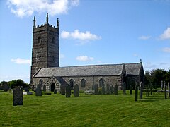
St Eval
| |
|---|---|
 St Eval church | |
Location within Cornwall | |
| Population | 732 (civil parish 2011)[1] |
| OS grid reference | SW883685 |
| Civil parish |
|
| Unitary authority | |
| Ceremonial county | |
| Region | |
| Country | England |
| Sovereign state | United Kingdom |
| Post town | WADEBRIDGE |
| Postcode district | PL27 |
| Dialling code | 01841 |
| Police | Devon and Cornwall |
| Fire | Cornwall |
| Ambulance | South Western |
| UK Parliament | |
St Eval (Cornish: S. Uvel)[2] is a civil parish and hamlet in north Cornwall, England, United Kingdom. The hamlet is about four miles (6.5 km) southwest of Padstow.[3] The parish population at the 2011 census was 960.[4]
Much of the village land was acquired by compulsory purchase in 1938 to build an RAF Coastal Command Station, RAF St Eval. Many buildings were demolished leaving only the Norman church, the Vicarage, and Trevisker Farm. These buildings were effectively surrounded by RAF activity, and during World War II were taken over for RAF use, with the church tower used as an observation post and navigation mark.
The parish incorporates the southern part of Porthcothan and the hamlets of Engollan and Treburrick.
- ^ "Civil Parish population 2011". Neighbourhood Statistics. Office for National Statistics. Retrieved 7 March 2017.
- ^ Place-names in the Standard Written Form (SWF) Archived 15 May 2013 at the Wayback Machine : List of place-names agreed by the MAGA Signage Panel Archived 15 May 2013 at the Wayback Machine. Cornish Language Partnership.
- ^ Ordnance Survey: Landranger map sheet 200 Newquay & Bodmin ISBN 978-0-319-22938-5
- ^ "Parish population 2011". Retrieved 13 February 2015.
