St Mary's Airport Isles of Scilly Airport Scilly Isles/St Mary's Airport | |||||||||||||||
|---|---|---|---|---|---|---|---|---|---|---|---|---|---|---|---|
 | |||||||||||||||
| Summary | |||||||||||||||
| Airport type | Public | ||||||||||||||
| Operator | Council of the Isles of Scilly | ||||||||||||||
| Serves | Isles of Scilly | ||||||||||||||
| Location | St Mary's, Isles of Scilly | ||||||||||||||
| Elevation AMSL | 116 ft / 35 m | ||||||||||||||
| Coordinates | 49°54′48″N 006°17′30″W / 49.91333°N 6.29167°W | ||||||||||||||
| Website | www | ||||||||||||||
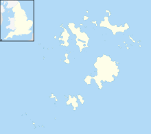
| Map | |||||||||||||||
 | |||||||||||||||
| Runways | |||||||||||||||
| |||||||||||||||
| Helipads | |||||||||||||||
| |||||||||||||||
| Statistics (2023) | |||||||||||||||
| |||||||||||||||
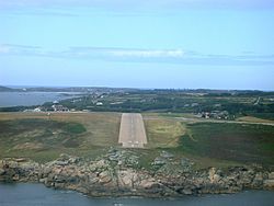
St Mary's Airport or Isles of Scilly Airport (IATA: ISC, ICAO: EGHE) is an airport located 1 nautical mile (1.9 km; 1.2 mi) east of Hugh Town on St Mary's in the Isles of Scilly, to the south west of Cornwall, UK. It is the only fixed-wing airport serving the Isles of Scilly, handling most air traffic to and from the Islands. (There is a heliport on the island of Tresco.) The airport is owned by the Duchy of Cornwall and currently is operated by the Council of the Isles of Scilly.
- ^ "Scilly Isles/St Mary's - EGHE". Archived from the original on 15 January 2016. Retrieved 25 May 2011.
- ^ "Annual airport data 2023: Tables 3, 9, 12 and 13.pdf". UK Civil Aviation Authority. Retrieved 3 April 2024.
