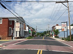
Stanardsville | |
|---|---|
 Central Stanardsville | |
 Location of Stanardsville within the Greene County | |
| Coordinates: 38°17′49″N 78°26′22″W / 38.29694°N 78.43944°W | |
| Country | |
| State | |
| County | Greene |
| Government | |
| • Mayor | Gary Ernest Lowe[1] |
| Area | |
| • Total | 0.36 sq mi (0.93 km2) |
| • Land | 0.36 sq mi (0.93 km2) |
| • Water | 0.00 sq mi (0.00 km2) |
| Elevation | 663 ft (202 m) |
| Population (2020) | |
| • Total | 349 |
| • Estimate (2019)[3] | 386 |
| • Density | 1,081.23/sq mi (417.11/km2) |
| Time zone | UTC−5 (Eastern (EST)) |
| • Summer (DST) | UTC−4 (EDT) |
| ZIP code | 22973 |
| Area code | 434 |
| FIPS code | 51-75008[4] |
| GNIS feature ID | 1500151[5] |
| Website | www |
Stanardsville is a town in Greene County, Virginia, United States. The population was 349 at the 2020 census,[6] down from 367 at the 2010 census. It is the county seat of Greene County.[7] The name is from Robert Stanard, a benefactor who donated land for public use. It is part of the Charlottesville, Virginia metropolitan area.
- ^ "Virginia Elections Database - Gary Ernest Lowe". Virginia Elections Database. Retrieved 2022-04-28.
- ^ "2019 U.S. Gazetteer Files". United States Census Bureau. Retrieved August 7, 2020.
- ^ "Population and Housing Unit Estimates". United States Census Bureau. May 24, 2020. Retrieved May 27, 2020.
- ^ "U.S. Census website". United States Census Bureau. Retrieved 2008-01-31.
- ^ "US Board on Geographic Names". United States Geological Survey. 2007-10-25. Retrieved 2008-01-31.
- ^ "Geographic Identifiers: 2010 Demographic Profile Data (G001): Stanardsville town, Virginia". U.S. Census Bureau, American Factfinder. Retrieved March 29, 2017.[dead link]
- ^ "Find a County". National Association of Counties. Retrieved 2011-06-07.


