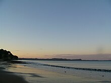
Stanmore Bay | |
|---|---|
 The main road on Whangaparaoa Peninsula | |
 | |
| Coordinates: 36°38′00″S 174°44′00″E / 36.6333308°S 174.7333304°E | |
| Country | New Zealand |
| City | Auckland |
| Local authority | Auckland Council |
| Electoral ward | Albany ward |
| Local board | Hibiscus and Bays |
| Area | |
| • Land | 740 ha (1,830 acres) |
| Population (June 2024)[2] | |
• Total | 13,290 |
| Postcode(s) | 0932 |
| Red Beach | (Whangaparaoa Bay) | |
| Stillwater |
|
Manly |
| (Weiti River) | (Karepiro Bay) | Wade Heads |


Stanmore Bay is a suburb and beach located on the Whangaparaoa Peninsula, in the Auckland Region of New Zealand. The beach is on the northern side of the peninsula.[3]
- ^ Cite error: The named reference
Areawas invoked but never defined (see the help page). - ^ "Aotearoa Data Explorer". Statistics New Zealand. Retrieved 26 October 2024.
- ^ Peter Dowling, ed. (2004). Reed New Zealand Atlas. Reed Books. pp. map 11. ISBN 0-7900-0952-8.