| Stansbury South Australia | |||||||||||||||
|---|---|---|---|---|---|---|---|---|---|---|---|---|---|---|---|
 Dalrymple Hotel at Stansbury | |||||||||||||||
| Coordinates | 34°55′0″S 137°47′0″E / 34.91667°S 137.78333°E | ||||||||||||||
| Population | 480 (UCL 2021)[1] | ||||||||||||||
| Established | 1873 | ||||||||||||||
| Postcode(s) | 5582 | ||||||||||||||
| Time zone | ACST; UTC+09:30 (UTC) | ||||||||||||||
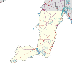
| Location | |||||||||||||||
| LGA(s) | Yorke Peninsula Council | ||||||||||||||
| State electorate(s) | Narungga[2] | ||||||||||||||
| Federal division(s) | Grey | ||||||||||||||
| |||||||||||||||
Stansbury (postcode 5582) is a small town, located in the southern east coast of Yorke Peninsula, South Australia. It is located 25 kilometres (16 mi) south of Minlaton and 22 kilometres (14 mi) east of Yorketown. It faces the Gulf St Vincent across Oyster Bay, where shellfish were originally harvested in the 19th century. The town has also been a port used in the export of wheat and barley to Adelaide.[4]
- ^ Australian Bureau of Statistics (28 June 2022). "Stansbury (urban centre and locality)". Australian Census 2021.
- ^ Narungga (Map). Electoral District Boundaries Commission. 2016. Retrieved 1 March 2018.
- ^ a b c d e f g h "New Ward Structure 2014". Yorke Peninsula Council. Archived from the original on 15 January 2016. Retrieved 21 October 2015.
- ^ South Australia Cities and Towns, 1st Edition. UBD (A Division of Universal Press Pty Ltd). 1995. ISBN 0-7319-0636-5.
