| The Stari Grad Plain | |
|---|---|
| Native name Croatian: Starogradsko polje | |
 The Stari Grad Plain | |
| Location | Split-Dalmatia County, |
| Coordinates | 43°10′54″N 16°38′19″E / 43.18167°N 16.63861°E |
| Type | Cultural |
| Criteria | ii, iii, v |
| Designated | 2008 (32nd Session) |
| Reference no. | 1240 |
| Europe and North America | |
| Official name | Starogradsko polje |
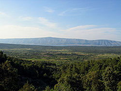
The Stari Grad Plain, near the town of Stari Grad on the island of Hvar, Croatia, is an agricultural landscape that was set up by the ancient Greek colonists in the 4th century BC, and remains in use. The plain is the largest agricultural area on any of the Adriatic islands, and is remarkably fertile due to Ice Age loess deposition.[1] This landscape is almost entirely preserved from its original form. The ancient layout has been preserved by careful maintenance of the stone walls over 24 centuries, along with the stone shelters (known locally as trims[2][3]), and the water collection system. The same crops, mainly grapes and olives, are still grown in the fields, and the site is also a natural reserve. The site is a valuable example of the ancient Greek system of agriculture, and was inscribed as a UNESCO World Heritage Site in 2008.[4]
- ^ International Council on Monuments and Sites (ICOMOS) (11 March 2008). The Stari Grad Plain (Croatia): No. 1240 (PDF) (Report). Retrieved 22 May 2021.
- ^ Stone Shelters on Hvar by Borut Juvanec
- ^ The Trims of Hvar, by Berislav Horvatić
- ^ "Stari Grad Plain". UNESCO World Heritage Centre. United Nations Educational, Scientific, and Cultural Organization.

